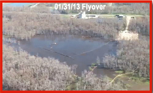
Still from sinkhole flyover 01.31.13
(Image by Assumption Parish Police Jury, used with permission) Details DMCA
This is the ninth article in this Opednews series about the Bayou Corne sinkhole.
BACKGROUND: In Spring of 2012, Louisiana's Corne and Grand Bayou residents noticed strange bubbling in the bayou for many weeks, and they reported smelling burnt diesel fuel and sulfur. Then suddenly a sinkhole the size of three football fields appeared on Aug. 3, swallowing scores of 100-foot tall cypress trees. The sinkhole resulted from the failure of Texas Brine Company's abandoned underground brine cavern. The Department of Natural Resources issued a Declaration of Emergency on Aug. 6, and 150 families were evacuated.
For maps, diagrams and additional information, please see the eight previous articles in this series:
8. Just Released: Wildly Bubbling Gases Near Catastrophic Louisiana Sinkhole (Jan. 22, 2013) at click here
7. Gov. Jindal Ignores Sinkhole Disaster; Activists & Scientists Demand Assistance for Traumatized Residents (Jan. 20, 2013) at click here
6. Sudden Seismic Activity in Louisiana Bayou: Sinkhole Burps, Pad Cracks, Police Copter Arrives UPDATED (Jan. 19, 2013) at click here
5. Bayou Sinkhole Site Update: Flammable Tap Water (Nov. 2, 2012) at click here4. Alarming Sinkhole Continues to Cave In: Seismic Activity, Odors, Health Symptoms Reported (Oct. 30, 2012) at click here
3. Mysterious Bayou Sinkhole Continues to Cave In: Radiation, Hydrocarbons Detected (Sept. 29, 2012) at click here
2. Dangerous Levels of Radium at Corne Bayou Sinkhole (Aug. 26, 2012) at click here
1. Does Sudden Sinkhole Portend a Nuclear-sized Explosion? (Aug. 17, 2012) at click here
Napoleonville, LA:
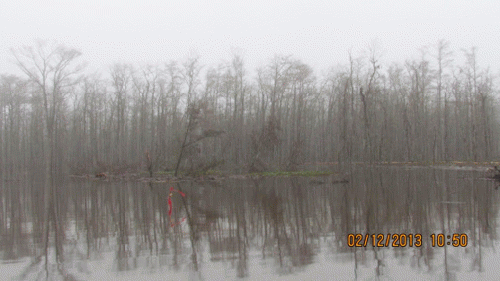
The nightmarish Louisiana sinkhole in Bayou Corne continues to swallow up land on its perimeter. Around mid-day on Feb 12, the newest cave-in was reported. An estimated 50 x 100 foot section caved in on the southwest side of the sinkhole.

Newest cave-in area, Louisiana sinkhole.
(Image by Assumption Parish Police Jury, used with permission) Details DMCA
The most recent cave-in prior to this one was reported on Dec. 12, 2012.
The photos below compare the sinkhole in still shots from flyovers in August and January. (Note: none of these photos shows the sinkhole at exactly the same angle. Therefore some estimation was involved in showing the relative sizes of the photos. The road and position of trees at lower left, the bases of the white cylindrical structures at the top of the photos, and the position of the pad area at right were used to line up these images with each other. Note that the pad area has undergone changes in size and shape during the last few months.)
(Note: You can view every article as one long page if you sign up as an Advocate Member, or higher).


