This update is the 11th article in this Opednews series about the Bayou Corne sinkhole.
BACKGROUND: In Spring of 2012, Louisiana's Corne and Grand Bayou residents noticed strange bubbling in the bayou for many weeks, and they reported smelling burnt diesel fuel and sulfur. Then suddenly a sinkhole the size of three football fields appeared on Aug. 3, swallowing scores of 100-foot tall cypress trees. The sinkhole resulted from the failure of Texas Brine Company's abandoned underground brine cavern. The Department of Natural Resources issued a Declaration of Emergency on Aug. 6, and 150 families were evacuated.
For maps, diagrams and additional information, please see the ten previous articles in this series, listed at the end of this article.

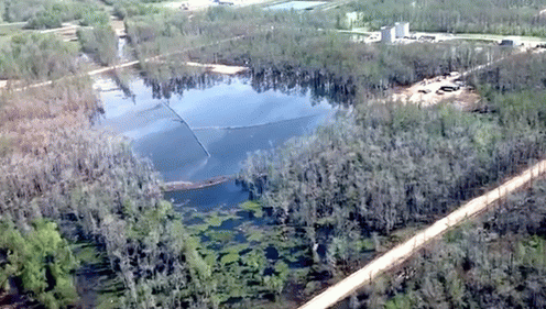
Sinkhole flyover photo, 03.21.13
(Image by Assumption Parish Police Jury, used with permission) Details DMCA
NAPOLEONVILLE, LA: On March 26, 2013, the relentlessly treacherous Louisiana sinkhole swallowed 25 more trees.
Yesterday, the Assumption Parish Police Jury announced, "The Office of Conservation, in consultation with Assumption Parish Incident Command, is advising the public that a slough-in occurred last night along the southeastern side of the sinkhole -- approximately 25 trees fell into the sinkhole along the southeastern side and a new crack, running parallel to the sinkhole edge, was observed on the Oxy 3 well pad access ramp to the sinkhole. Experts with Conservation and CB&I believe the slough-in event is linked to the period of elevated subsurface fluid and gas movement detected late last week in the area around the sinkhole and Oxy 3, as has been observed in previous similar events."

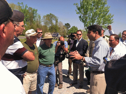
Gov. Jindal made his first visit to Bayou Corne
(Image by Assumption Parish Police Jury, used with permission) Details DMCA
On March 19, Louisiana Governor Jindal made his first visit to the Bayou Corne community since the crisis began in August, 2012.
Nine days before yesterday's cave-in, on Sunday, March 17, a large "burp" event was recorded at the sinkhole. (A "burp" is typically characterized by hydrocarbon and debris on the surface.)
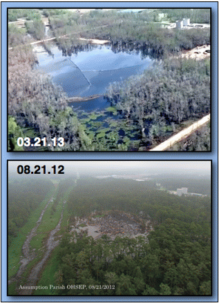
The photos above show the sinkhole's growth during seven months, from August 21, 2012, through March 21, 2013.
At a public briefing on Jan. 30, 2013, a representative from Texas Brine noted that the size of the sinkhole was about 8.6 acres, noting, "when i include the areas of subsidence around the sinkhole, it is between 15 and 16 acres."
The two cave-ins in March have expanded the size of the sinkhole, but the exact size is not yet available.
Previous articles in this series:
10. Over 90 "Micro" Earthquakes Overnight at the Bayou Corne Sinkhole (MAR. 13, 2013) click here
(Note: You can view every article as one long page if you sign up as an Advocate Member, or higher).


